Helping health systems plan ahead
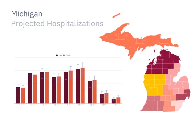
Epistemix forecasted hospital admissions, emergency department visits, and capacity alerts for facilities across a Michigan health system, to plan for a COVID-19 surge.


Epistemix forecasted hospital admissions, emergency department visits, and capacity alerts for facilities across a Michigan health system, to plan for a COVID-19 surge.

Chicago regulators used the Epistemix synthetic population to simulate the epidemiological impacts of the entire event calendar at McCormick Place and across the city.
Epistemix worked with a coalition of ISPs to inform long-term infrastructure investments by comparing scenarios of population internet use in Boulder, CO.
Riverview School District superintendents leveraged the Epistemix platform to evaluate the human impacts of competing reopening strategies.
With their sophisticated analytical tools, Epistemix provides the insights we need to chart a course toward not just recovery, but resilience.